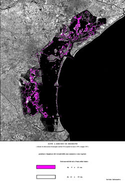
ZONES
EXPOSED TO EROSION HAZARD
(Obtained
by processing of Landsat-TM images acquired between March 1990
and May 1993)
Slopes dip and length of submerged
zones not covered with vegetation
Tidal levels surveyed at Punta della Salute:
from -9 cm, to -21 cm.
from -21 cm, to -33 cm.
To
visualize more details click on the image.
The
original images, in TIFF format, were made available by
Consorzio
Venezia Nuova - Information Service.
